
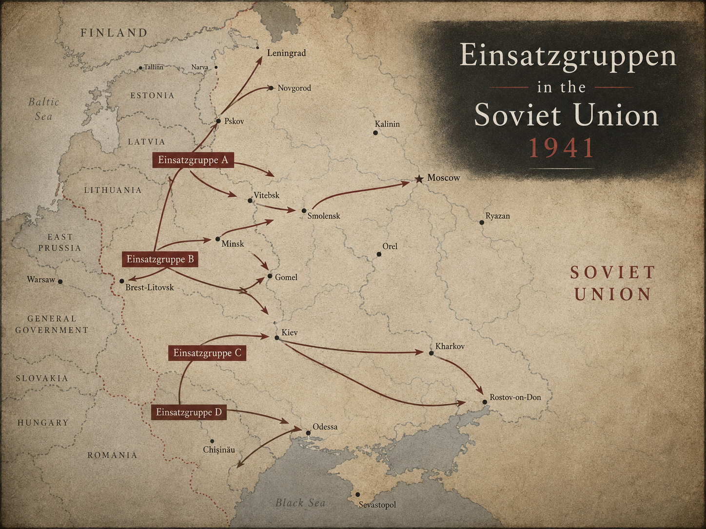
Unit: Sonderkommando 4b (Einsatzgruppe C). Place on map: Krementchug (modern name: Kremenchuk), Ukraine. Date on map: 30 September 1941.
Coordinates: 49.068, 33.4204 (approximate modern locality centroid; verify before final publication).
On 30 September 1941, the map places SK 4b, within Einsatzgruppe C in or near Krementchug (modern Kremenchuk), Ukraine. This record should be used first as a route/presence marker derived from the map, not as proof that a specific killing action took place on that exact date and in that exact locality. Einsatzgruppe C operated across Ukraine toward Kiev and Donetsk. USHMM names Lvov/Lviv, Tarnopol/Ternopil, Zolochev, Kremenets, Kharkov/Kharkiv and Kiev/Kyiv among places connected with its killing operations. The wider context is Operation Barbarossa and the rapid transition from persecution and occupation policy to mass murder by mobile SS and police killing units behind the German front. For publication, verify the locality and date against the Ereignismeldungen UdSSR, Yad Vashem's 'Untold Stories' locality project, USHMM locality articles/collections, and, where available, Yahad-In Unum material on killing sites and testimony. Map note: SK4b-route en datum leesbaar.
Further research search terms: Krementchug | Kremenchuk | SK 4b | Einsatzgruppe C | 30 September 1941 | Ereignismeldungen UdSSR | Yad Vashem Untold Stories | USHMM
Sources and starting points for further research:
https://commons.wikimedia.org/wiki/File:Karte_-_Einsatzgruppen_in_der_Sowjetunion_1941.png
https://encyclopedia.ushmm.org/content/en/article/einsatzgruppen-and-other-ss-and-police-units-in-the-soviet-union
https://www.yadvashem.org/research/research-projects/untold-stories-intro.html
https://collections.arolsen-archives.org/de/archive/1-2-7-20_2273000
https://www.yadvashem.org/holocaust/about/final-solution-beginning/mass-murder-in-ussr.html
https://studyguide.yiu.ngo/en/holocaust-by-bullets